In modern city and town planning, real-time traffic data and high-precision digital maps are becoming indispensable tools for creating smarter, safer, and more sustainable urban environments. As cities worldwide face increasing congestion, air pollution, and infrastructure strain, data-driven mobility solutions enable planners to make informed, evidence-based decisions that improve how people and goods move.
1. Enabling Smarter, Real-Time Mobility Management
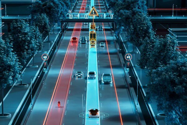
Mapping and traffic data provide city planners with deep insights into how roads, vehicles, and public transport systems are used. Through connected vehicles, GPS-enabled smartphones, and community-generated data, cities can monitor traffic flow, identify congestion hotspots, and adjust management strategies in real-time. Platforms like TomTom Orbis Maps allow for adaptive and precise mapping, giving cities unprecedented visibility into travel patterns and network performance.
2. Supporting Efficient Infrastructure Planning and Investment
Traffic analytics help governments and urban planners understand where to invest in infrastructure improvements. By analysing origin-destination data, planners can identify where shifting trips from private cars to public transport, cycling, or walking would yield the greatest impact. This evidence-based planning ensures that funds are allocated to projects that provide the maximum return on investment, particularly in reducing congestion and improving mobility efficiency.
3. Promoting Sustainable, Multimodal Transport Systems
Traffic and mapping data are crucial for rebalancing the modal split — encouraging a shift from private car use to public and active transport. Cities can use this data to develop integrated transport systems where buses, trains, bikes, and pedestrians are seamlessly connected. By understanding how, when, and why people travel, planners can design safer cycling routes, pedestrian-friendly zones, and reliable public transport networks, supporting both sustainability and livability goals.
4. Enhancing Road Safety and Risk Management
The same data that manages congestion can also enhance traffic safety. Real-time traffic analytics can detect hazards such as sudden stops, road construction, or severe weather conditions (fog, snow, rain) and alert drivers in advance. These insights help reduce accidents and support the development of advanced driver assistance systems (ADAS) and autonomous vehicles that require lane-level precision. Traffic data also helps governments plan roadworks strategically, minimising disruption and risk to road users.
5. Strengthening Disaster Response and Resilience
Traffic and mobility data play a vital role during emergencies such as floods, fires, or storms. By integrating official emergency data into navigation systems, cities can implement disaster-aware routing to keep people out of danger zones. Community-generated reports and vehicle movement data also assist in identifying affected areas and supporting emergency response planning, proving that traffic data can help save lives during crises.
6. Powering AI-Driven Decision Making
Artificial intelligence enhances the value of traffic data by analysing vast datasets more efficiently than humans. AI can detect patterns, predict congestion, and recommend interventions such as optimising signal timings or rerouting traffic. When combined with clear policy direction and urban planning expertise, AI-driven systems become powerful tools for adaptive traffic management and long-term urban mobility planning.
7. Guiding Policy and Behavioural Change
While technology provides data, policy and planning determine outcomes. The integration of mapping and traffic data must align with political and community goals—such as reducing emissions, improving accessibility, or supporting active transport. Cities that pair data insights with strong governance can influence travel behaviour and design policies that make urban systems more sustainable and people-centred..
Conclusion
Maps and traffic data are reshaping how cities and towns plan, manage, and future-proof their transport systems. They provide real-time insights that drive smarter infrastructure investment, enhance safety, promote sustainability, and improve overall mobility efficiency.
When combined with artificial intelligence, sound policy, and community collaboration, data-driven mapping transforms urban spaces into resilient, liveable, and people-first environments — where planning decisions are guided by evidence rather than assumption.